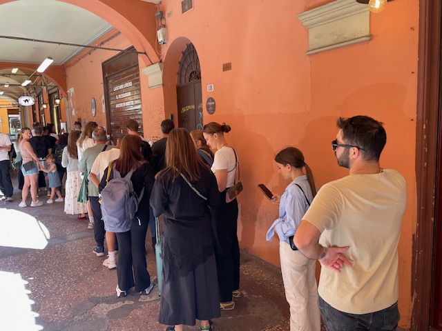
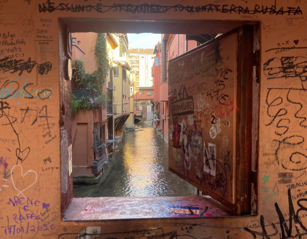
The window on the canal, or Finistrella, in Via Piella is a popular spot for tourists to take a photo of a short section of canal. But what is the significance of this stretch and how does it fit into the bigger picture?
In this post, I’ll look in some detail at the canal system that was an essential part of Bologna’s cityscape and economy for 8 centuries. I’ll also describe a few walks along canals not far from the city centre.
The need for canals
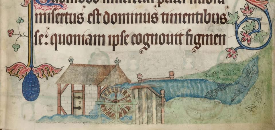
From around the tenth century, there was a technology revolution in Europe which led to growth in population, trade and free enterprise. In particular, water mills had multiple industrial uses in processes such as fulling cloth, sawing timber, tanning, making paper and throwing silk. The efficient grinding of wheat by mills was a key enabler of population growth.
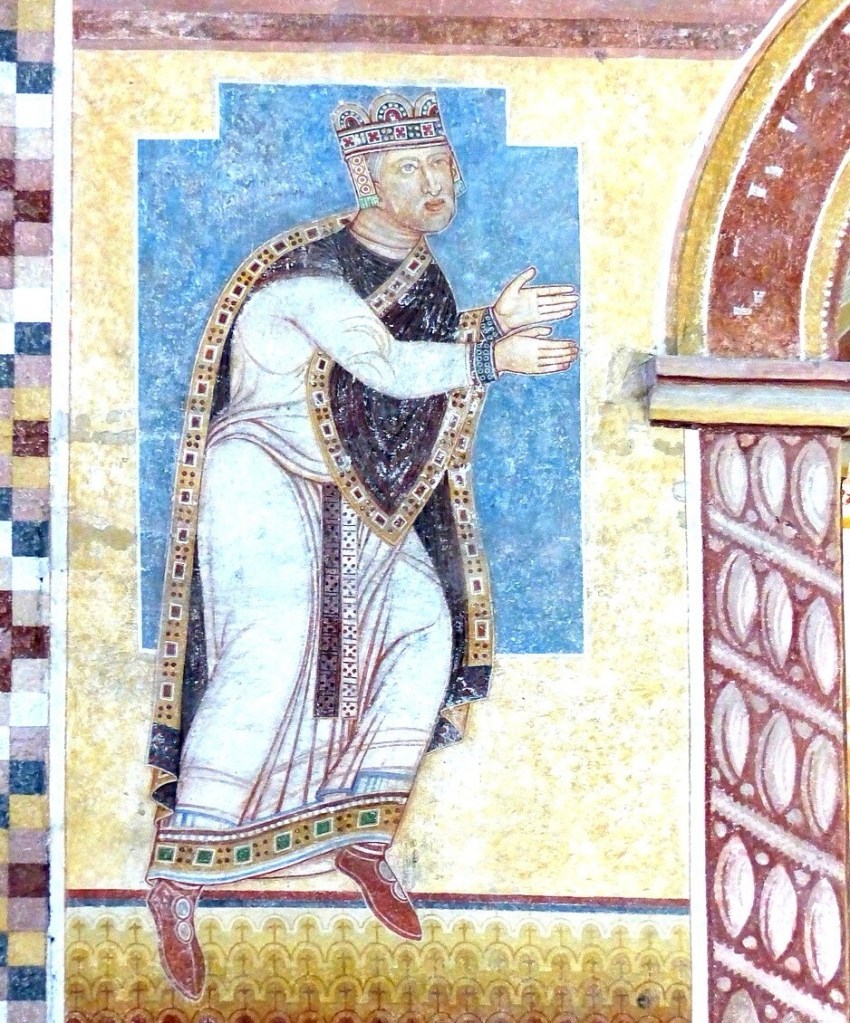
From the 11th century, Italian towns such as Bologna experienced a revitalisation of trade and commerce, with an accompanying rapid growth in population. In 1116, the Holy Roman Emperor Henry V granted Bologna a set of privileges which further spurred growth.
To enable growth in its industry and population, fast flowing water was needed to power mills and factories. Bologna is not built on a river, although a creek called the Àposa, long covered over, flows through the city.
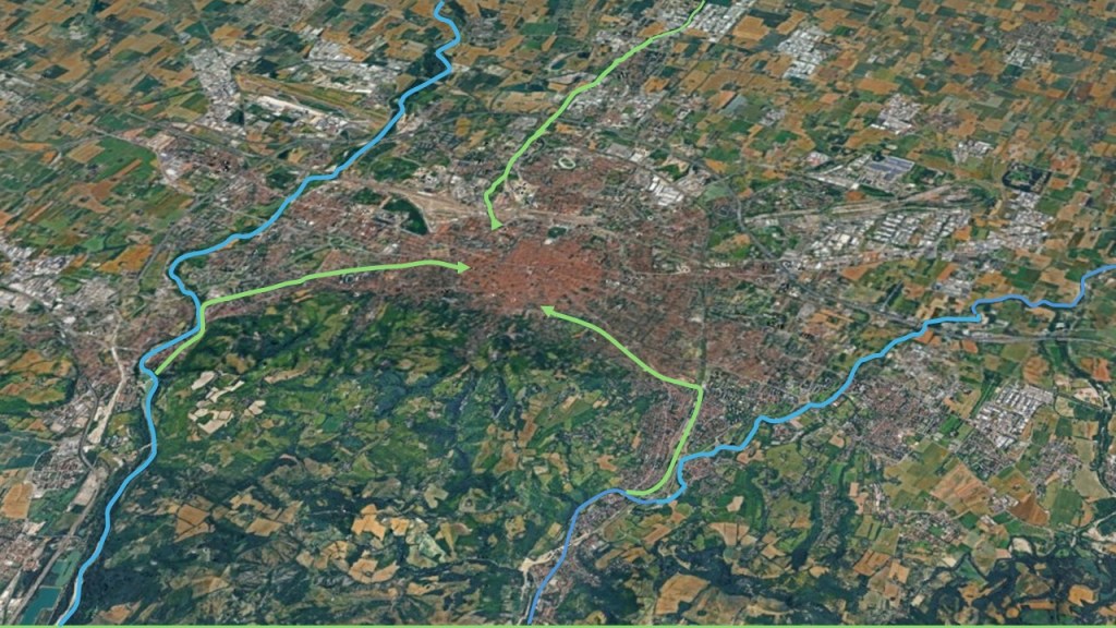
Canals were built to channel water from the Reno and the Savena, two rivers that flow either side of Bologna, into the city. This water then fed into a navigable canal, which was Bologna’s major commercial transport link.
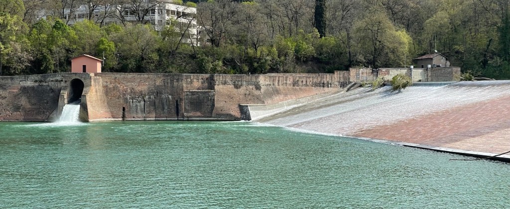
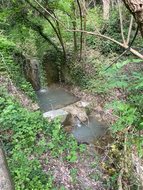
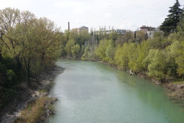
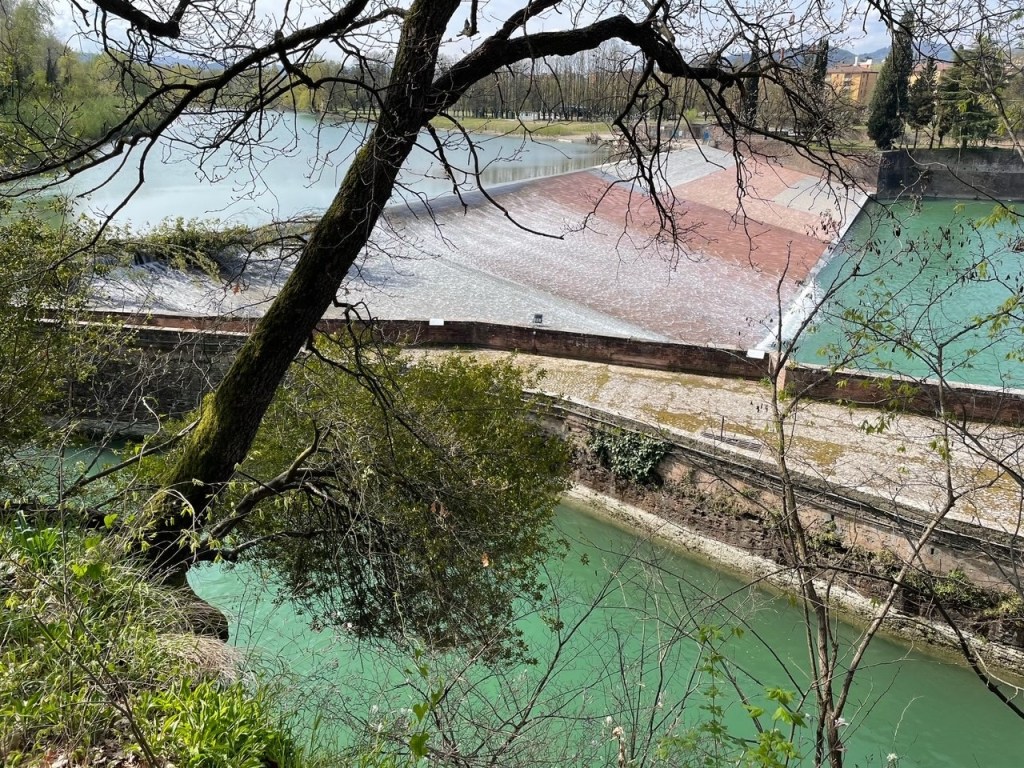
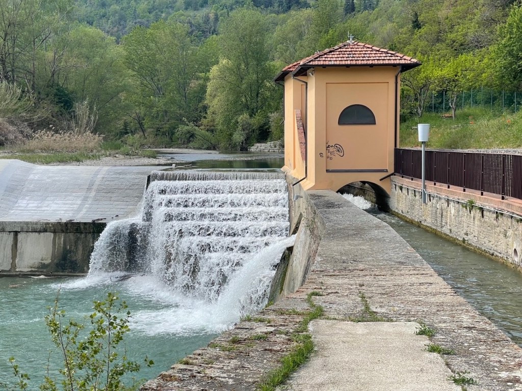
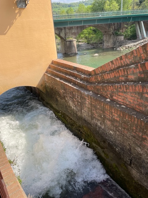
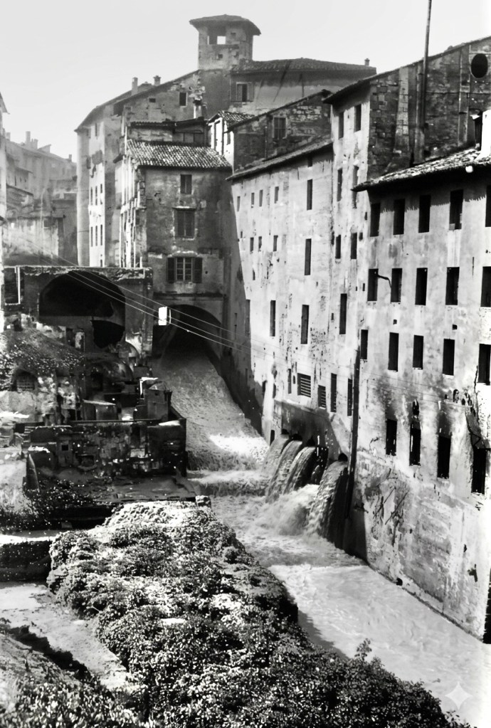
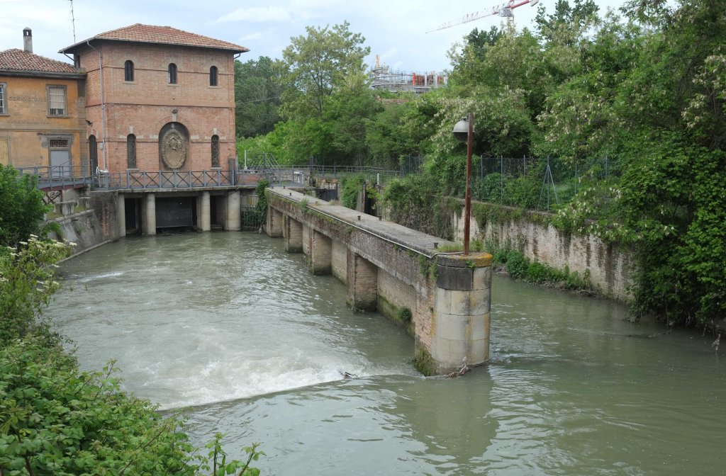
To improve the consistency of water flow through the seasons, weirs were built across both rivers creating small reservoirs from where the canals began. In the image below, the Reno Canal runs in a channel at the top of the wall. A small spillway at the left clears the canal of sediment buildup and floating objects such as tree branches and sheets of ice.
Bologna’s canals
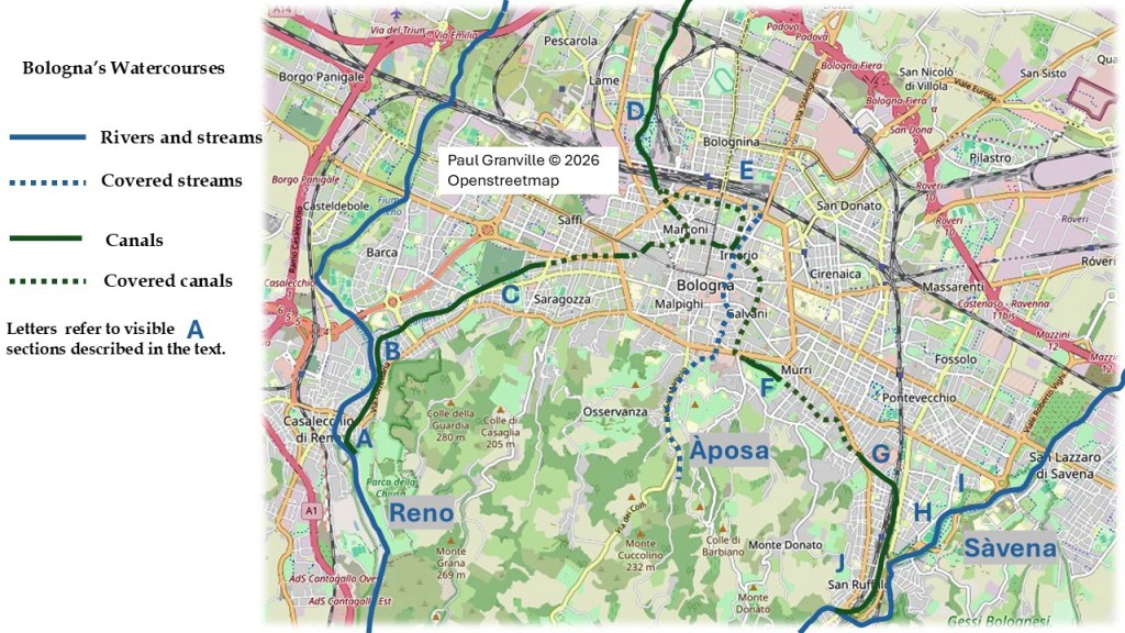
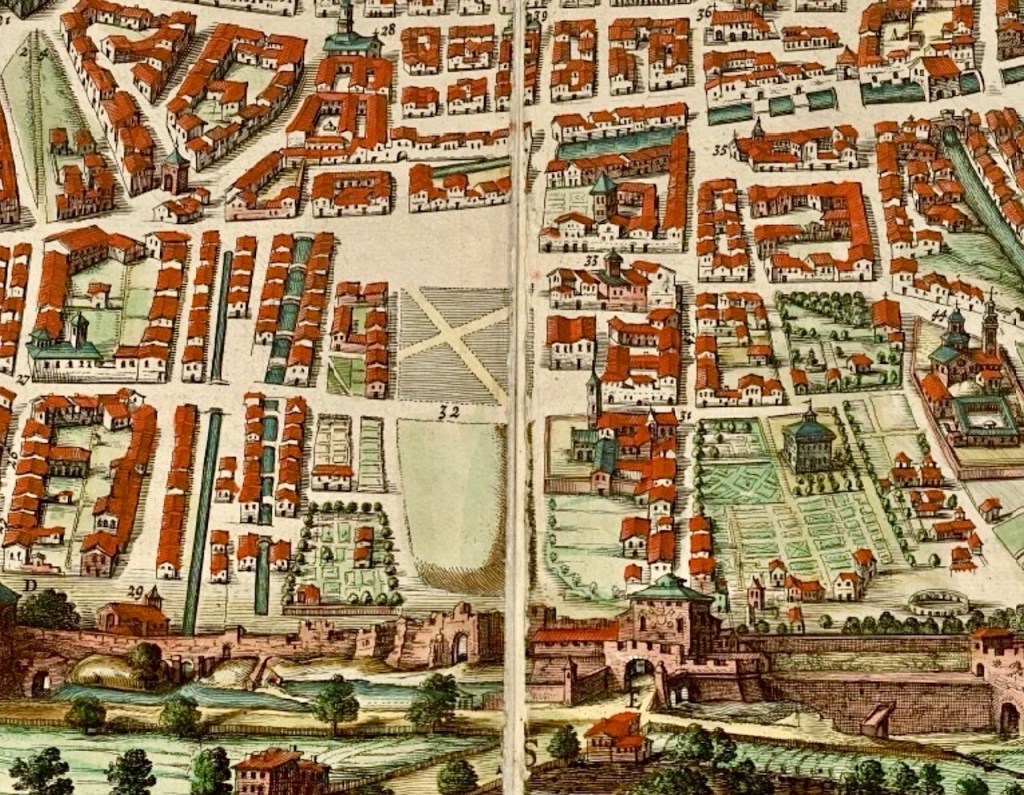
The map below gives an overview of the system. Natural watercourses are shown in blue and major canals in green, with capital letters giving the approximate location of images in the post. Water from the River Reno enters the Reno Canal at location A, and the Savena Canal begins at location J. A small stream called the Àposa passes through the city underground and its waters flow into the canal system at location E, behind Montagnola Park.
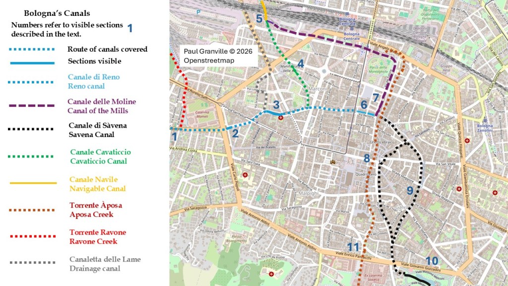
My second map gives a closer view of the city, with locations marked by numbers.
An interesting aspect of Bologna’s canal system was the construction of a network of conduits allowing mills and factories to be established in locations other than along the major canals.
Bologna’s canals powered many mills, both along the way to the city and within the walls.
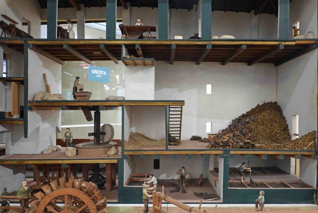
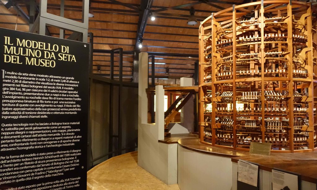
The development of the round silk mill allowed automatic twisting of silk thread, and pushed Bologna to the forefront of silk production.
Towards the end of the 16th century, some 16,000 men, women and children out of a total population of about 60,000 were working in silk mills. A century later, there were over 350 silk mills. Silk from Bologna was sought after across Europe until competition and changes in fashion led to the eventual collapse of the industry in the late 18th century.
The canals also provided water for the irrigation of market gardens, clothes washing, street cleaning, removal of effluent, and tanneries. The defensive moats around the city walls were fed from the canals and were also used to raise fish.
The water of all the canals as well as the Àposa fed into the Navile, a navigable canal which was the principal method by which goods entered and left the city. The canals continued to be used well into the 20th century, and from the late 19th century, hydro-electric power stations have operated in various locations along Bologna’s canals.
The Àposa
While no river passes through Bologna, a small stream named the Àposa flows down the valley followed by Via San Mamolo and then through the centre of Bologna, but has long been covered over.
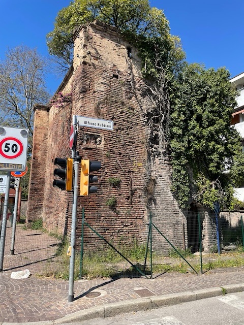
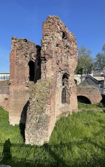
A remaining fragment of the third and final set of city walls (see my post The Walls of Bologna for more) marks the point where the Áposa entered Bologna through a grate similar to the one on the Reno Canal.
Map reference 11. (P.Granville)
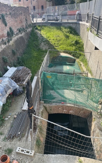
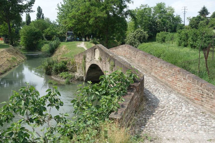
In 1918, road works uncovered a Roman bridge over the Àposa built in the first century. It’s located beneath number 34 Via Rizzoli, near the twin towers (Map reference 8). Via Rizzoli and Via Ugo Bassi were part of the Roman Via Emilia that stretched from Rimini to Piacenza.
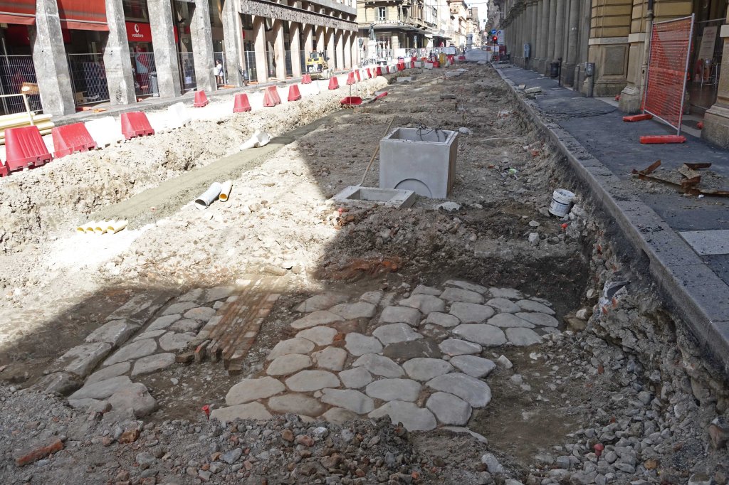
and Via Rizzoli lies the Roman road surface. (P. Granville)
The Reno Canal
The Reno River flows past Bologna’s western outskirts and eventually its waters enter the Adriatic just north of Ravenna.
The river once flowed into extensive marsh lands and frequently changed its course with devastating impact on local communities. In the 18th century, the Reno was diverted via a canal into the former riverbed of the Po, which had also changed its course.
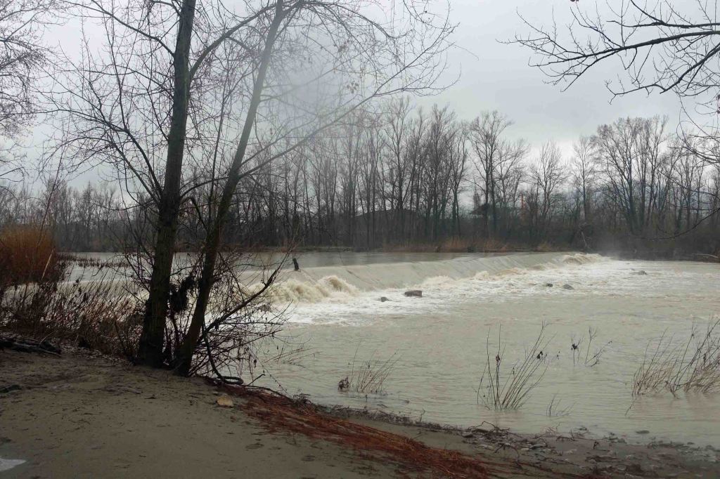
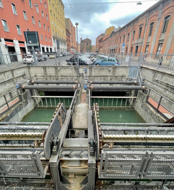
The first weir across the Reno River was probably built in the 11th century, but the current one was built around the year 1278. Over the ensuing centuries, the weir has been repaired and upgraded many times.
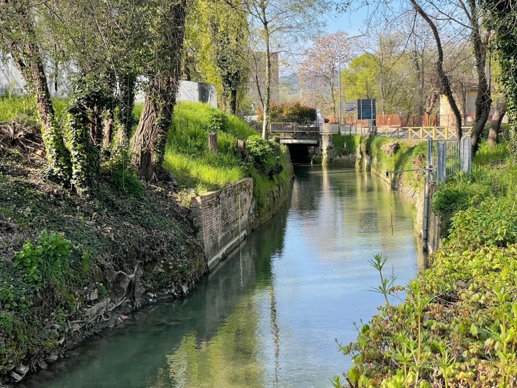
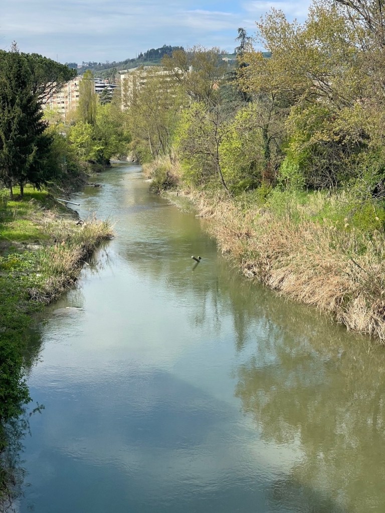
Water from the top of the weir feeds the Reno canal, which runs parallel to the river for some kilometres before turning towards the city.
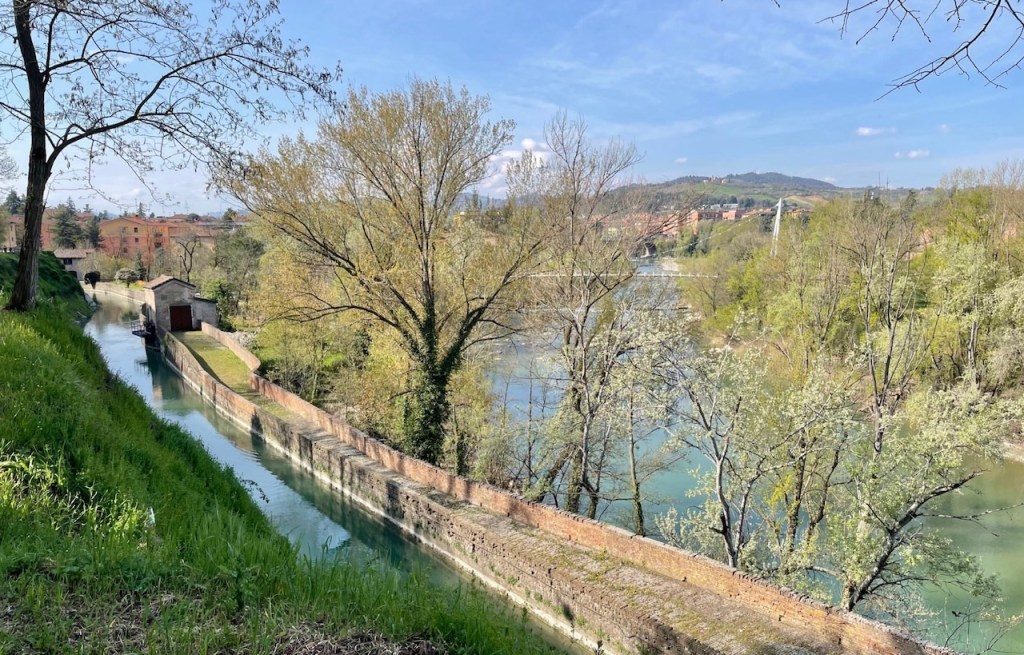
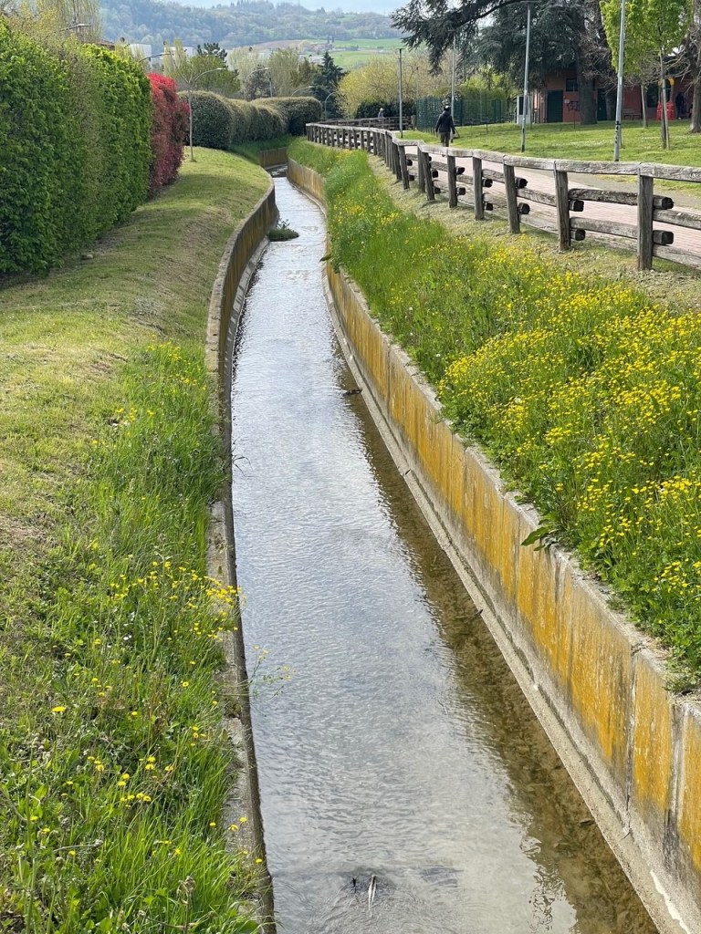
The canal can be followed on foot or by bicycle from near the Certosa Cemetery to Casalecchio.
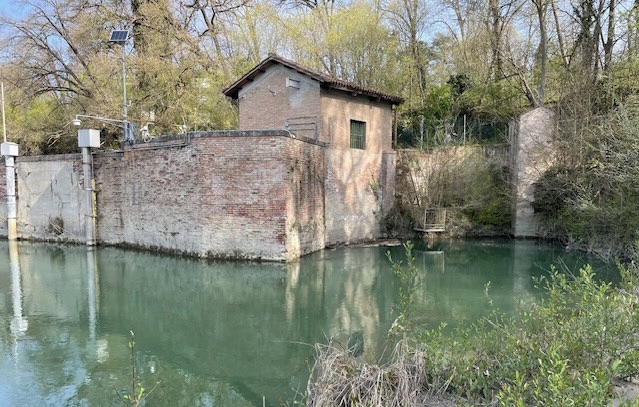
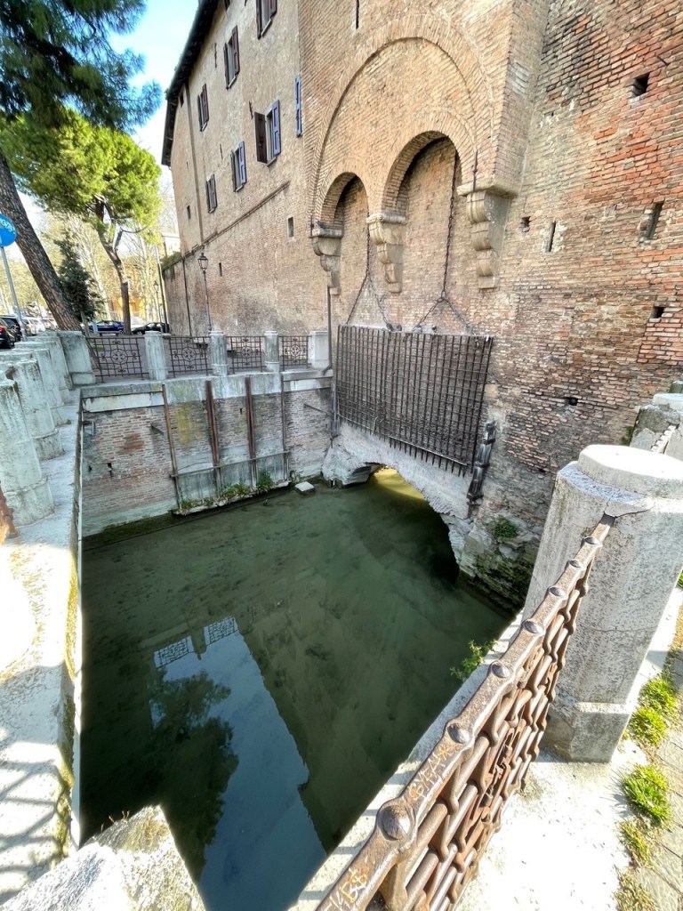
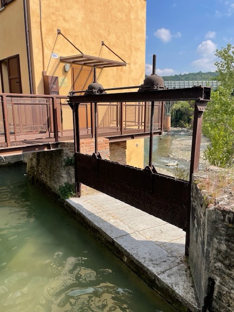
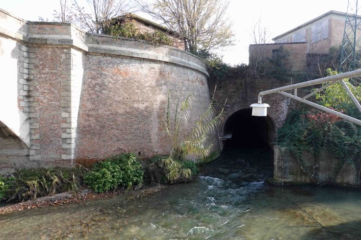
The Reno Canal enters the city through an opening under a surviving section of the 3rd set of city walls built between 1327 and 1390. A grate could be lowered to collect floating objects and prevent clandestine entry to the city.
Just beyond this point is l’Opificio delle Acque, or water works. Originally a tannery, it now houses a small museum. Check before visiting as at the time of writing it was closed for maintenance works.
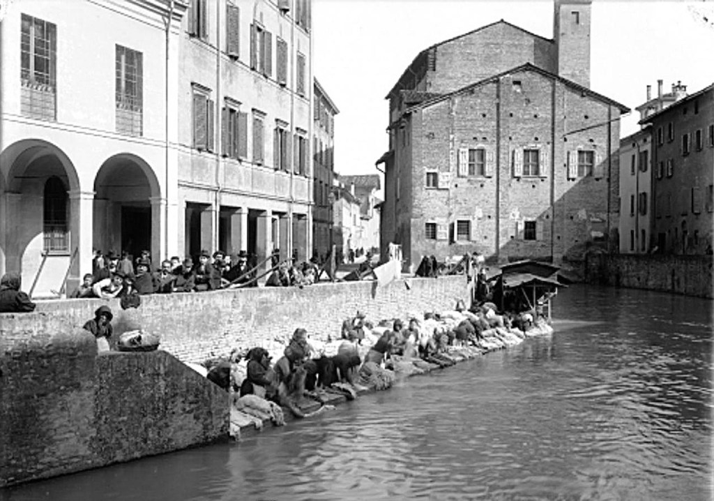
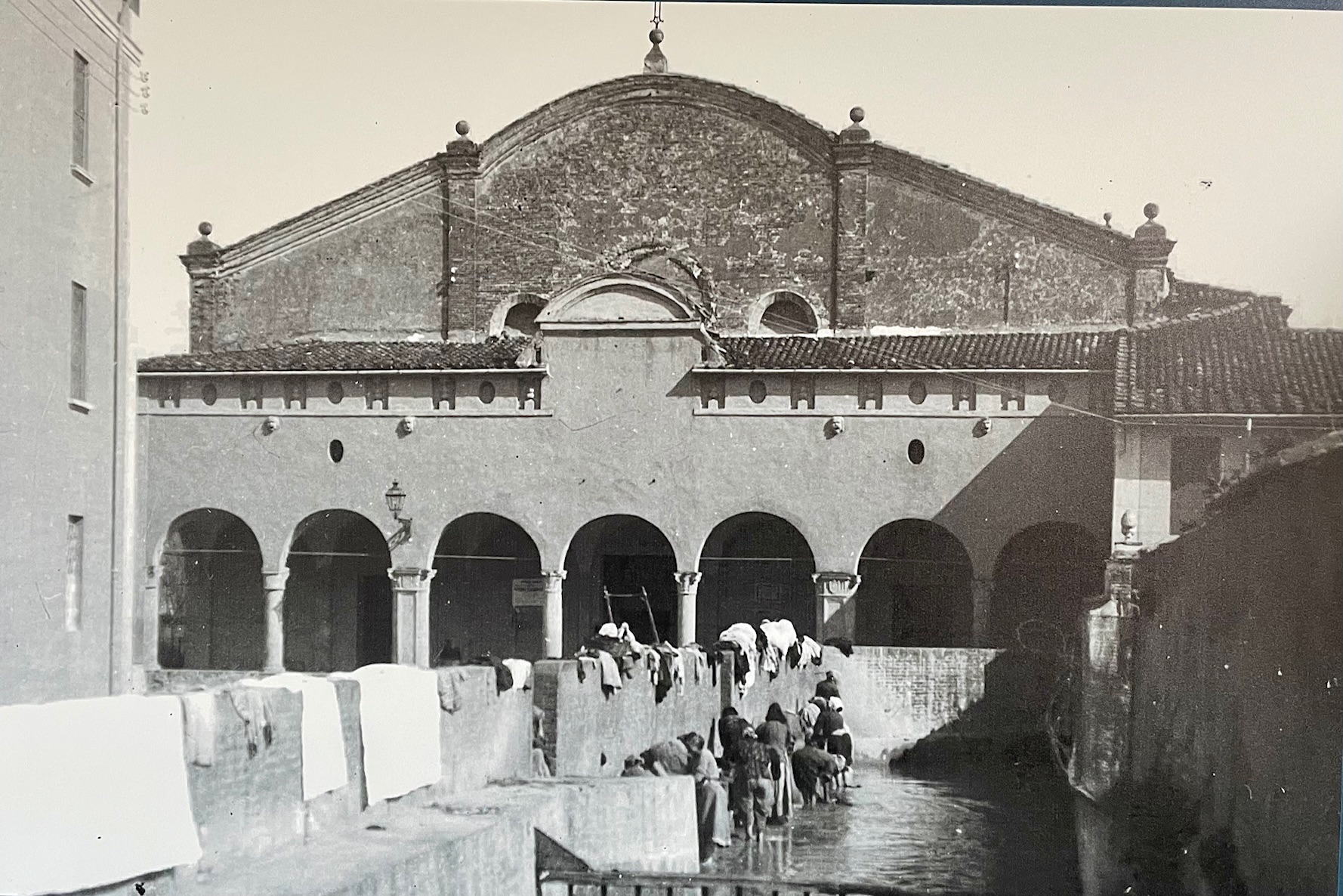
A little further along Via Riva di Reno, a controversial statue commemorates the generations of hard working washerwomen. See my post Bologna’s Public Statues for more. As recently as 1916, there were still 55 functioning laundries along the canal, as well as numerous washing locations for domestic use.

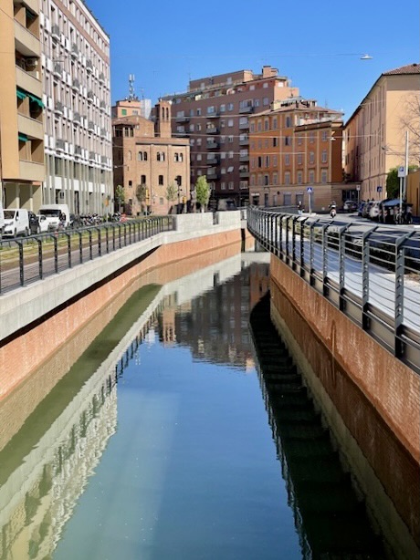
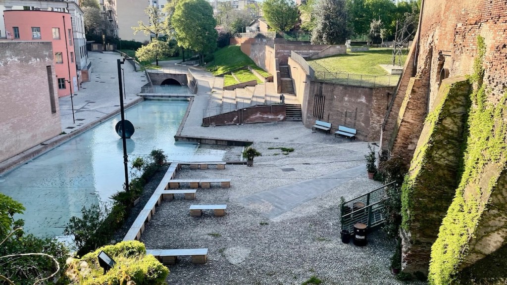
Around a bend in the street, in 2025 a section of canal, covered over in the 1950s, once again saw the light of day after works associated with the new tram line. There was some controversy due to the loss of parking spaces.
The canal passes under the church of Santa Maria della Visitazione, and a little farther down the street there’s another glimpse of the canal where a litter trap catches floating objects.
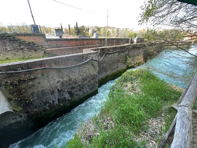
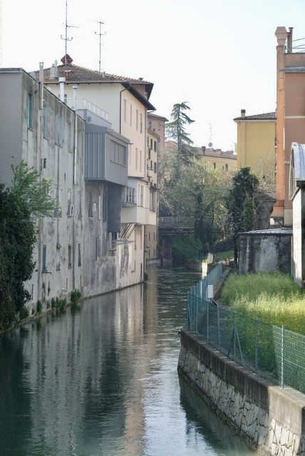
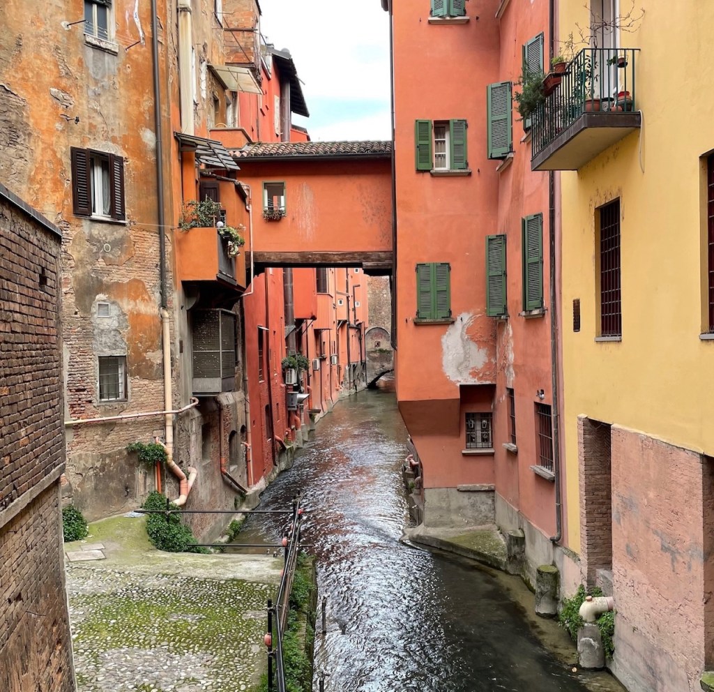
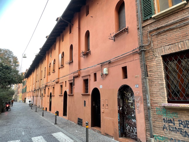
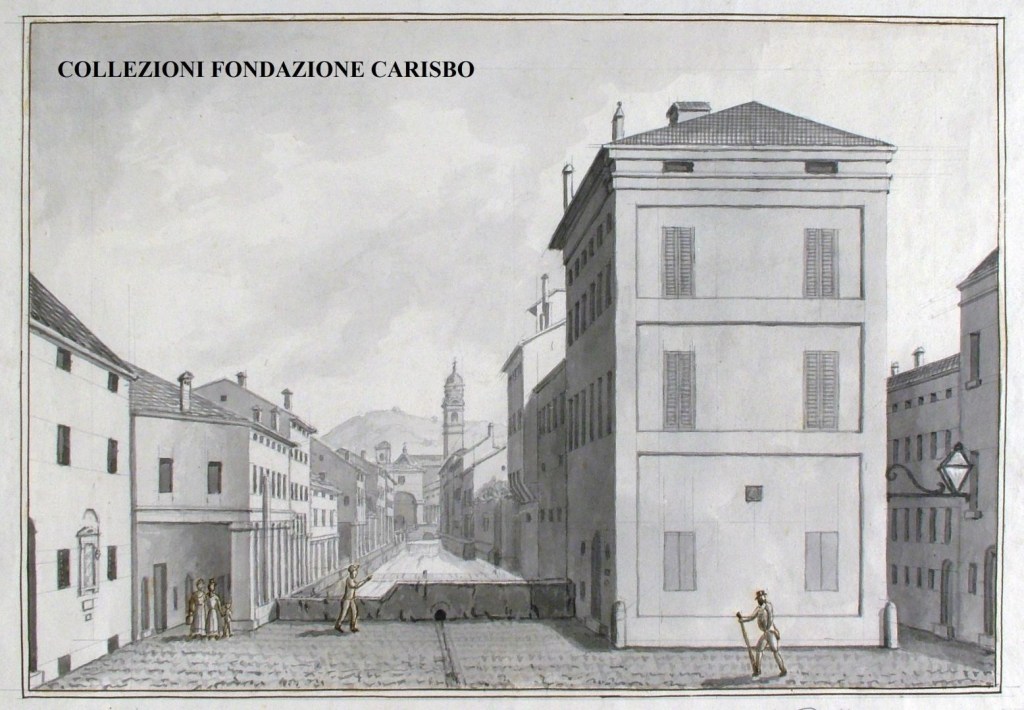
There is another long uncovered section of the canal visible from Via Malcontenti, Piella and Oberdan. At this location, the canal also formed part of the moat of the second set of city walls built in the 12th century.
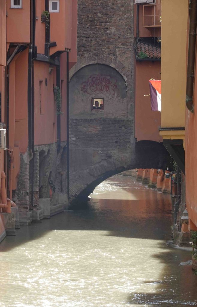
At the left of the image below, there’s a surviving ramp from 1219 used to water and wash horses and cattle. It’s visible from Via Righi.
Canal of the Mills
At Via Oberdan, between map references 6 and 7, the Reno Canal makes a 90 degree turn to the north. At this point once stood a church commonly called Sant Maria degli Annegati, or Saint Mary of the Drowned, as the bodies of people who had drowned in the canal were snagged at the bend and subsequently displayed in the church so that relatives could retrieve them.
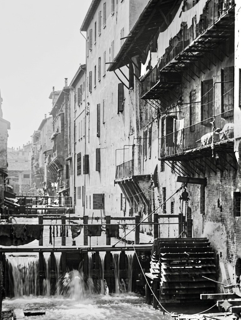
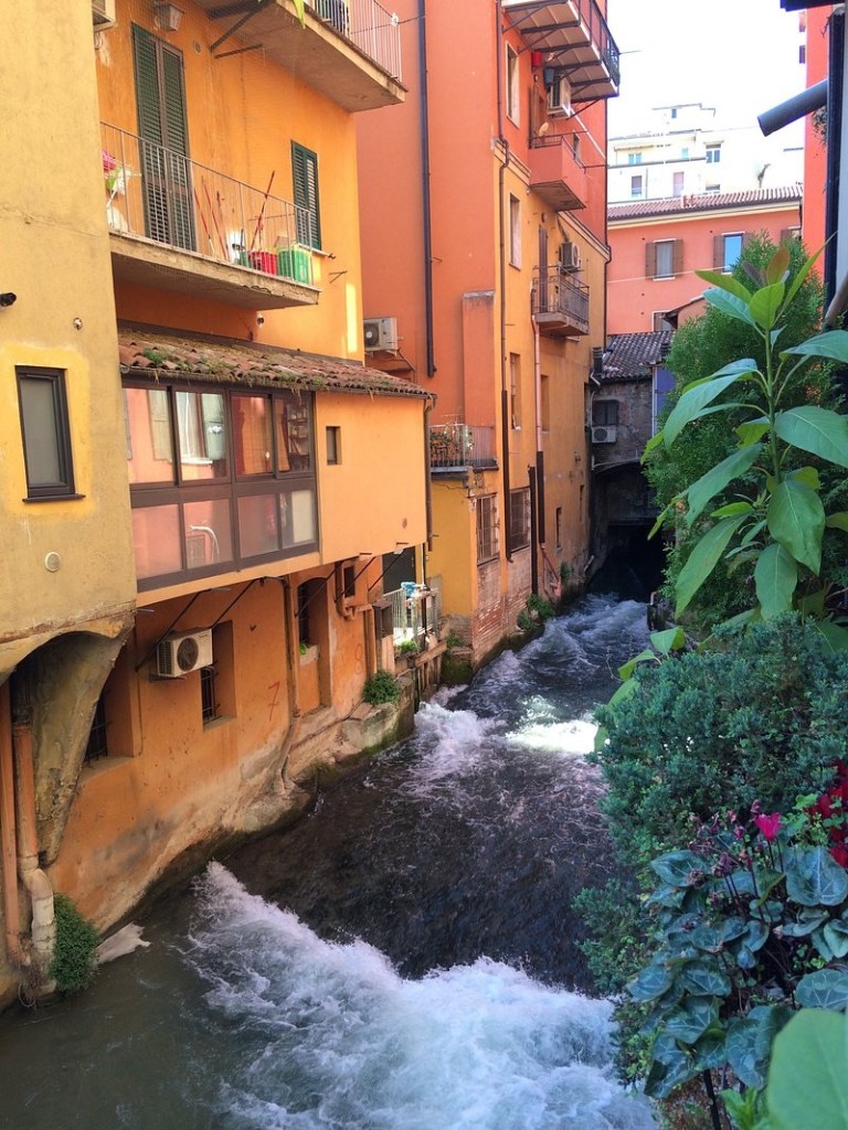
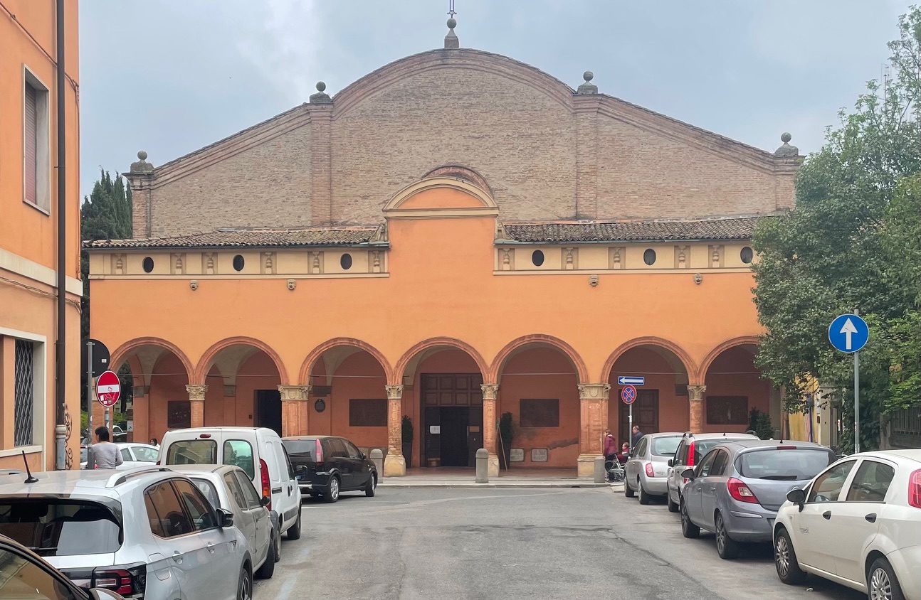
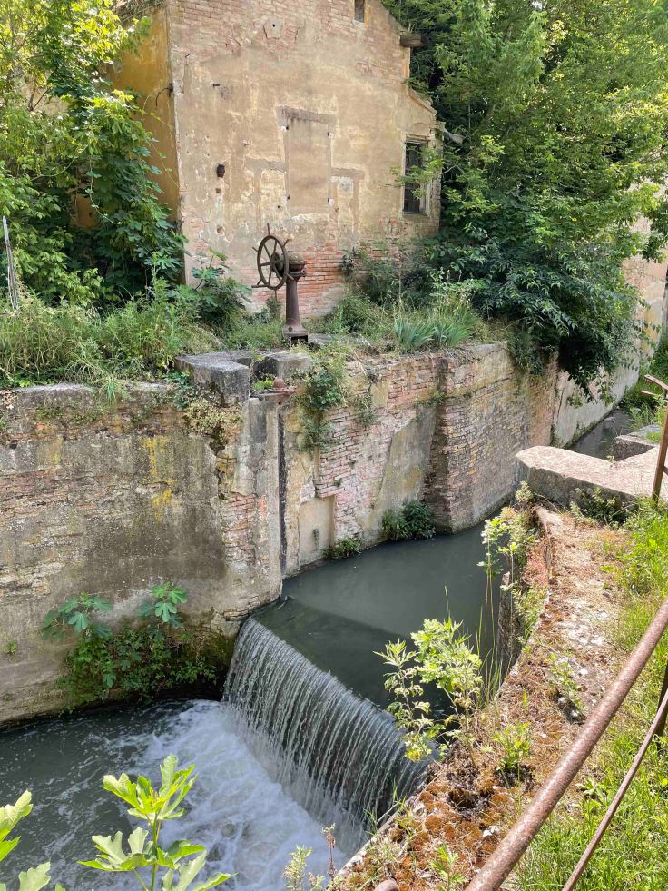
From here, there is a name change to the Canale delle Moline – the Canal of the Mills. There was a concentration of 15 grain mills along this section of canal from the Middle Ages until the early 20th century. As the canal descended via a series of 9 wooden barrages, there was ample energy to drive each mill.
Walking down Via Capo di Lucca, the sound of the canal is quite clear as it still runs above ground, although not visible from the street. There is a view from inside the Caffè Opera E Tulipani.
On the opposite side of Via Capo di Lucca is a row of houses built in the 16th century as homes for mill workers.
The canal makes another turn to the west and combines with the Àposa. There are glimpses near the ruins of the Galliera Fortress and Galliera Gate at the top of Via dell’Indipendenza. The water was used in the fortress for washing, cleaning, driving a mill and also fed a moat beyond the third set of walls.
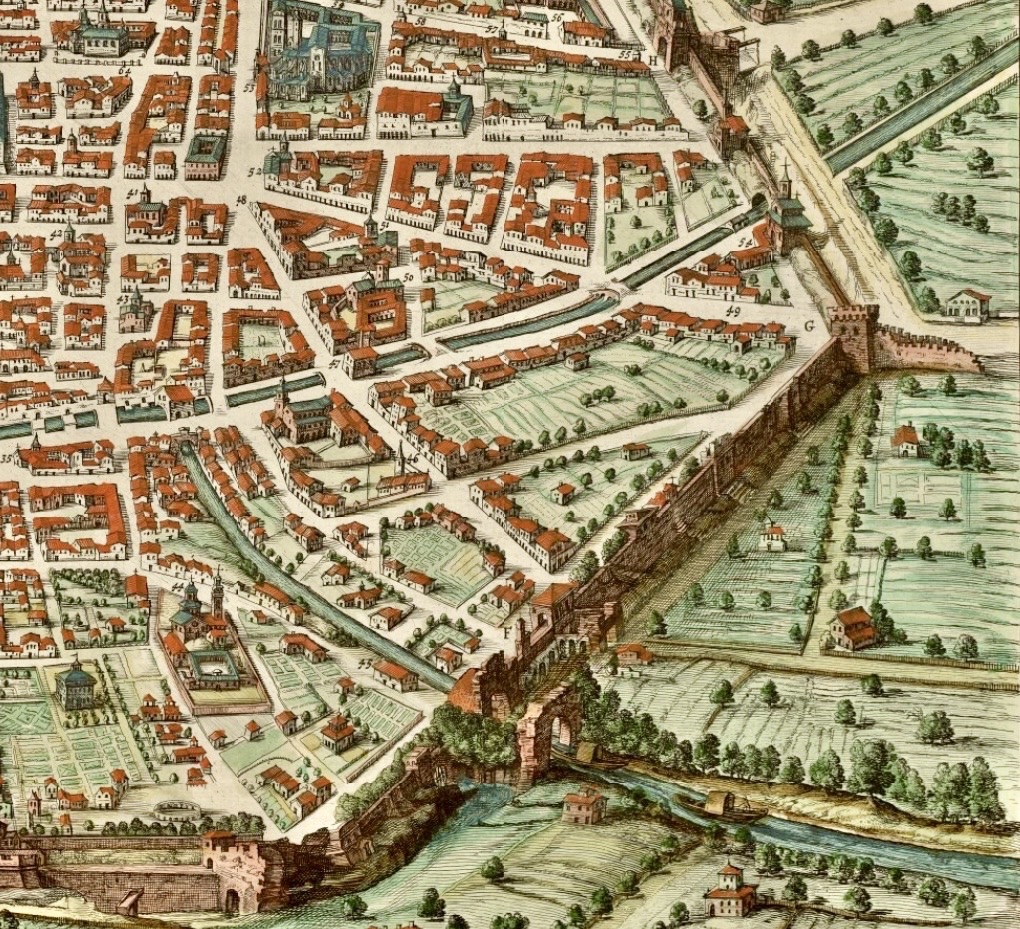
In the extract from a 17th century painting below looking towards the south, the Reno Canal crosses at the top from right to left. The Àposa and Canale delle Moline can be seen running in parallel on the left, combining just outside of the city walls. The fortress ruins are at the bottom just left of centre and the Galliera Gate right of centre.
The Savena Canal
The Savena is a smaller river than the Reno, flowing to the east of the city. It joins the Idice River which in turn is a tributary of the Reno.
The Savena canal is very much a smaller version of the Reno Canal, with a similar starting point at a weir south of the city. Its origins lie in the 12th century.
This canal heads north, providing water for market gardens along the way.
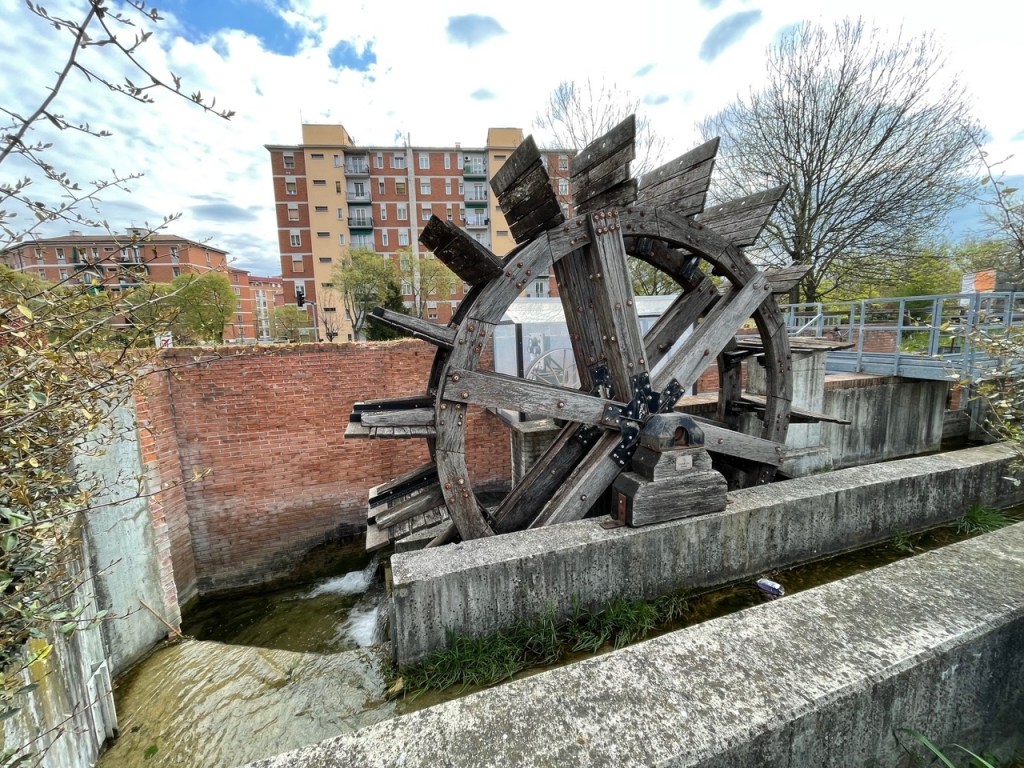
A reproduction mill wheel originally generated power for a number of street lights, but is no longer in working order.
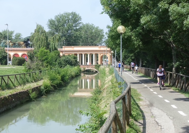
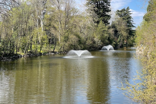
In 1879, the Margherita Gardens opened. A major feature was a lake fed by the Savena Canal.
After the gardens, the canal passed under the Church of Santa Maria della Misericordia where there was a laundry area, before turning towards the city walls. For more on this church, see my post Martin Luther in Bologna.
After entering the city, one major branch of the canal continued down Via Castiglione while another formed part of the moat of the second set of walls along Piazza Aldrovandi.
The two branches recombined, and joined the Áposa which eventually merged with the Canale delle Moline.
Cavaticcio Canal
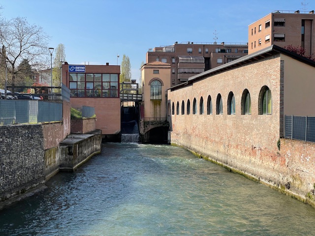
A short distance past the newly exposed section of the Reno Canal, it splits into two. At the Via Marconi pedestrian crossing near the PAM supermarket, there is often the sound of rushing water coming from under a manhole. The branch that heads to the north-west is called the Canale Cavaticcio.
Taking advantage of a descent of around 14 metres (46 feet) along this canal, a hydroelectric plant was installed on the Cavaticcio Canal in 1994.
A short section of the Cavaticcio Canal is visible near MAMbo, Bologna’s museum of modern art. This was the location of Bologna’s canal port, established in the mid-16th century.
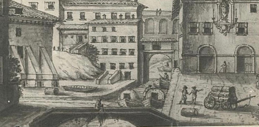
In the extract from the 17th century paining below, the Reno Canal crosses diagonally from right to left, and the Cavaticcio Canal branches down to the port, and then passes out through the city walls.
The port was the end point of the Navile – a navigable canal.
The Navile
From the tenth century, a canal connected Bologna with towns on the plains and the Adriatic Sea, terminating over time at various locations outside the walls. The buildup of silt was a constant problem. In 1284, a port was established outside the walls at the location of the image below.
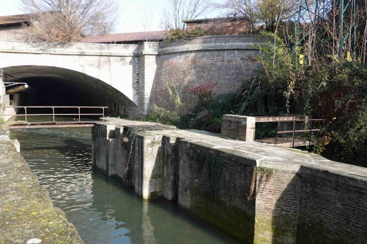
This the location of the junction of the Canale Cavaticcio and the combined waters of the Canale delle Moline, and the Àposa.
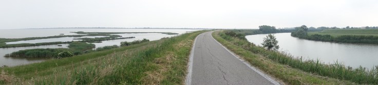
From here, the canal heads south for around 35km (22 miles) before joining the Reno River. It was used principally for the carriage of merchandise. The journey downstream required just the use of oars, while on the journey upstream to Bologna, boats were pulled by horses or oxen.
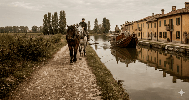
Passengers were also carried by canal boats, as the the journey was much smoother than on the rough roads of the time. On one notable occasion in 1501, Lucretia Borgia, the daughter of Pope Alexander VI, travelled by canal on her way from Rome to Ferrara, where she married Duke Alfonso I d’Este.
Locks known as ‘sostegni’ at 10 locations managed the descent of the canal to the plains below.
Walks
There is a pleasant walk along the Navile which I described in another post A Walk Along Bologna’s Navile.
As mentioned above, it’s also possible to walk for about 5km along the Reno Canal from the Certosa Cemetery ( see my post La Certosa – Bologna’s Fascinating Monumental Cemetery) to the start of the canal at Casalecchio. The first part of my Relive video of a walk following the Reno Canal follows this route, starting from Casalecchio.
https://www.relive.com/view/vrqDXjD81wq
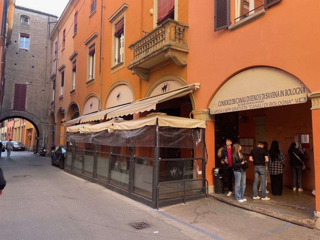
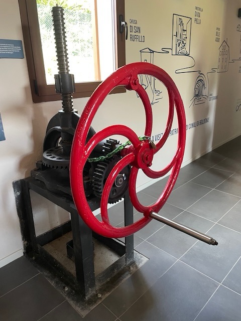
Accurate locations of many of the places mentioned in this post can be found using an interactive canal map on the site of the canal consortiums, the first of which was originally formed in the 16th century. They also run tours from time to time giving access to locations normally closed to the public, although they are often booked out in advance.
© P. Granville 2026

Leave a comment